
Our Services
- Civil Engineering
- Surveying & Mapping
- Storm Water (QSP/QSD) Services
- Program Management
- Construction Management
- Forensic Engineering
- Plan Check
 Civil Engineering Services
• Land Development Engineering
• Infrastructure Engineering
• Street Improvements
• Utility Improvements
• Grading Design
• Terrain Modeling
• Hydrologic, Hydraulic, and Hydromodification Calculations
• Cost Estimation
• Stormwater Retention Design
• 3D Modeling and Simulations
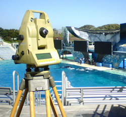 Surveying & Mapping Services
• Topograhic Surveys
• Boundary Surveys
• Right-Of-Way Surveys
• ALTA Surveys
• Record of Surveys
• Construction Staking and Layout
• Subsidence Level Monitoring
• Precise Level Circuits
• Control Surveys
• Aerial Control
• Boundary Adjustments
• Legal Descriptions and Plats
• Tentative Parcel Maps and Tentative Maps
• Parcel Maps and Final Maps
• FEMA Certifications
 Storm Water (QSP/QSD) Services
• Storm Water Pollution Prevention Plan (SWPPP)
• Linear Underground SWPPP
• Water Pollution Control Plan (WPCP)
• Minor Water Pollution Control Plan (MWPCP)
• Water Quality Technical Report/Storm Water Management Plan (WQTR/SWMP)
• Operations and Maintenance Plan
• Storm Water Monitoring
• Hydrology Reports
• Hydromodification Reports
• Erosion Control Plans
 Program Management Services
• Plan and Permit Processing
• Project Programming and Coordination
• Project Scheduling
 Construction Management Services
• Administration
• Review
• Coordination
 Forensic Engineering Services
• Consultation
• Expert Testimony
 Plan Check Services
• Private Development
• Public Works
• Final Maps
• Record of Survey